Route 6
Benton to Backworth

Click on the image for the Route 1 pamphlet
Directions
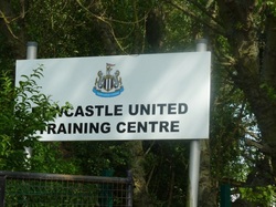
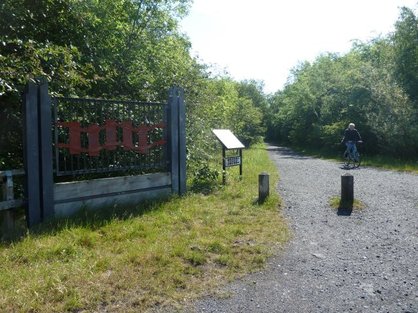
This route begins and ends at the Benton training ground of Newcastle United Football Club.
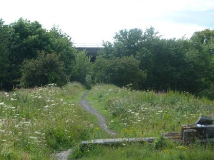
Facing the gates of the training ground there is a track off to the left. Follow this track over the North East main line railway and past East Benton Farm. The track crosses the A186 and continues towards the Rising Sun Country Park. As you cross the road you will see the old pit heap in the background.
Facing the gates of the training ground there is a track off to the left. Follow this track over the North East main line railway and past East Benton Farm. The track crosses the A186 and continues towards the Rising Sun Country Park. As you cross the road you will see the old pit heap in the background.
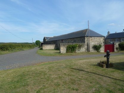 East Benton Farm |
 The Rising Sun pit heap in the background |
After you have passed over a small steam, turn right. Follow the path around to the left, heading towards a back street. At the far end of this back street turn left, up Kings Road North, towards the Rising Sun Farm.
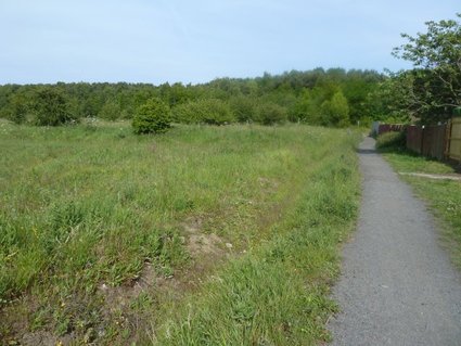
After 100 metres there is a wagonway off to the right. This is the route of the Rising Sun Colliery branch line. Follow this, through Battle Hill, under the A19, and to the back of the Silverlink Retail Park.
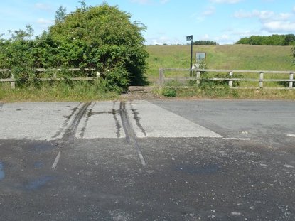 The last remaining tracks of the Rising Sun Branch Line |
 Start of the Rising Sun Branch Line |
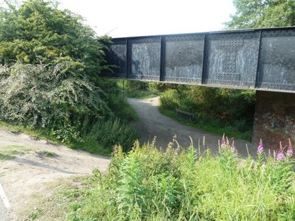
You will see the tracks of the Stephenson Railway Museum Railway, which passes over a bridge. Your route turns left, down a steep bank and under this bridge. Head North, following the old route of the Cramlington Wagonway and the NCN Route 10. This continues through Shiremore and across the A186. Just before you reach the Blue Bell pub you will see the site of the Bluebell pit on your right and a small mound that indicates the old pit heap.
Continue in a northerly direction, passing under the new bridge of the Shiremore by-pass. Bend round to the right then take the first left turn on to a disused road. You will pass through a farm which houses kennels.
Continue in a northerly direction, passing under the new bridge of the Shiremore by-pass. Bend round to the right then take the first left turn on to a disused road. You will pass through a farm which houses kennels.
 When you see the tracks of the Stephenson Museum Railway, turn left and go under the bridge. |
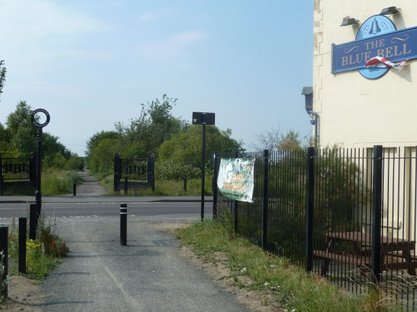 The Bluebell pub at Shiremoor. Continue across the road following the NCN Route 10 signs |
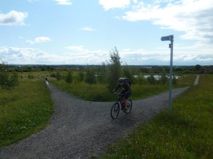
At the B1322, Backworth Lane, turn left. Follow the road trough Backworth village. Pass West Farm and look for the NCN Route 10 signposting the track which passes under the A19.
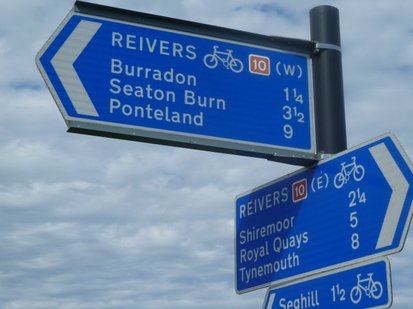 Follow the NCN Route 10 signs |
 Go under the A19 and up an incline |
This track follows the route of the Burradon and Holywell wagonway. Just after the top of the hill take the left turn and the path that heads to the south west corner of the field. Head through the housing estate, cutting between houses, and cross the B1505 at Burradon.
Here the wagonway now joins the route of the Seaton Burn Wagonway. Follow this until it crosses the main line railway. Immediately turn left and follow the spur that connected Weetslade Colliery to the NER line, heading in a southerly direction.
Here the wagonway now joins the route of the Seaton Burn Wagonway. Follow this until it crosses the main line railway. Immediately turn left and follow the spur that connected Weetslade Colliery to the NER line, heading in a southerly direction.
 Take the left track following the NCN Route 10 sign |
 The Weetslade spur, parallel to the mainline railway |
When a mound blocks your way, turn right and down the embankment into a field. Turn left after 30 meters and follow a bridlepath towards White House Farm. ( Path not marked on O.S. map.) This can be muddy in wet conditions, or rutted in dry weather!
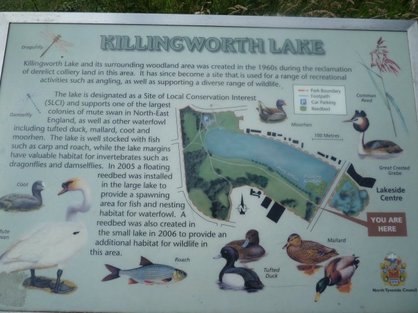
Follow the track past the farm and round to the level crossing. Turn left, crossing the main line and just after the Station Pub take the footpath to the right, through some trees and across to Killingworth Lake.
Follow the track past the farm and round to the level crossing. Turn left, crossing the main line and just after the Station Pub take the footpath to the right, through some trees and across to Killingworth Lake.
 Bridlepath to White House farm |
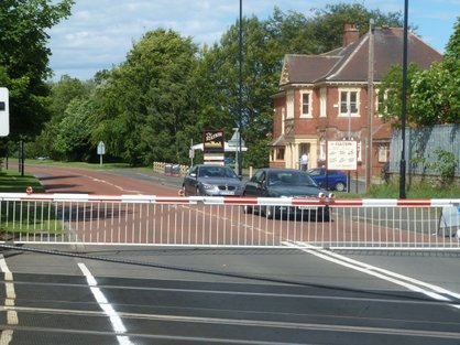 Killingworth level crossing. Turn right after the pub. |
The area around the lake is the former site of the Killingworth Colliery. Follow the track keeping the lake on your left hand side. Cross the road and turn right. Look out for the path that heads off to the left trough a line of tall trees. Follow this round to the Great Lime road, the B1505. On your right is a row of houses called Paradise Row, where George Stephenson lived at Dial Cottage.
 |
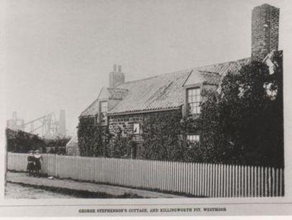 Dial Cottage |
Cross the road at the traffic lights and head down Glebe Road for about 300 metres. Look for a right turn leading to Forest Hall Primary school. Take this road, Delaval Road, until you reach the B1317. Turn right, passing Cycological, and as the road bends right, continue straight on along West Croft road. Follow this until it bends to the left. Continue straight, parallel to the North East mainline railway. The road turns into a track and passes under the Metro line and then over a bridge to the Oval. Turn left here until you can turn left again at Grange Avenue. You will see Whitley road and the entrance to the NUFC training ground.
