Route 7
Benton to Tanfield Railway

Click on the image for the Route 1 pamphlet
Directions
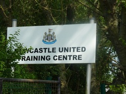
This route begins and ends at the Benton training ground of Newcastle United Football Club.
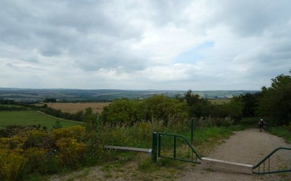
Facing the gates of the training ground there is a track off to the left. Follow this track over the main line railway and past East Benton Farm. The track crosses the A186 and continues towards the Rising Sun Country Park. As you cross the road you will see the old pit heap of the Rising Sun Colliery in the background.
Facing the gates of the training ground there is a track off to the left. Follow this track over the main line railway and past East Benton Farm. The track crosses the A186 and continues towards the Rising Sun Country Park. As you cross the road you will see the old pit heap of the Rising Sun Colliery in the background.
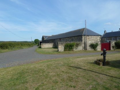 East Benton Farm |
 The Rising Sun pit heap in the background |
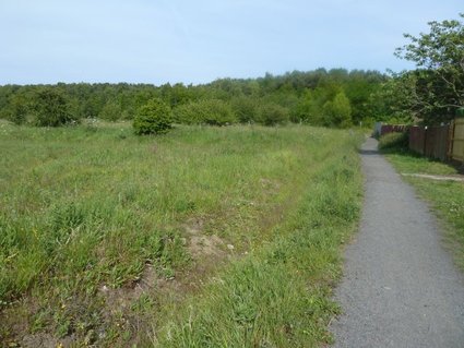
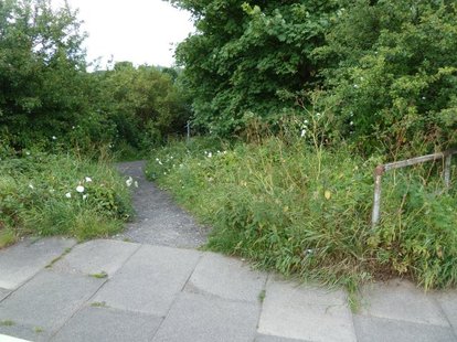
After you have passed over a small stream, turn right. Follow the path around to the left, heading towards a back street. At the far end of this back street turn left, up Kings Road North, towards the Rising Sun Farm.
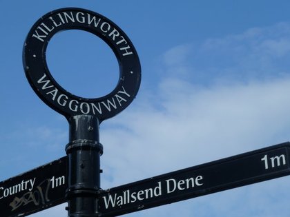
After 100 metres there is a wagonway off to the right. This is the route of the Rising Sun Colliery branch line. Follow this for 300 metres until a sign showing the Killingworth Wagonway. Turn right here and follow the path towards the Coast Rd, A1058.
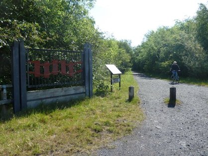 Start of the Rising Sun Branch Line |
 Turn right towards Wallsend Dene |
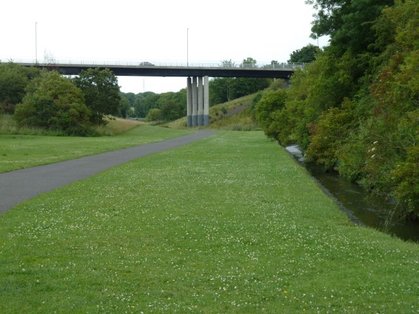
Use the subway to go under the Coast Road and follow the path down into Wallsend Dene. This track, which follows the route of the Killingworth Wagonway, is the one one that bears left immediately you come out the subway and has a NCN Route 72 sticker on a post. Keep right at the split in the track and be careful as the track becomes quite steep at the bottom.
 Bear left as you exit the Coast Rd subway |
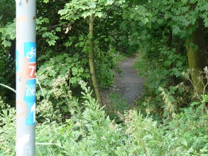 Follow the Route 72 signs down into the dene |
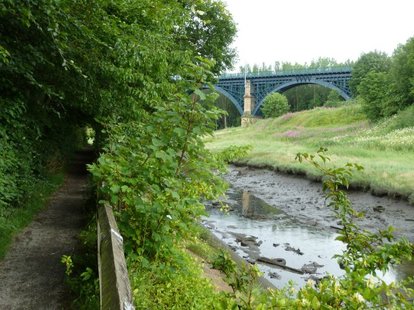
Follow the dene under the road bridge until you reach a road. Cross this using the crossing and look for a small path that cuts through some trees and follows Willington Gut.
 The route of the Killingworth Wagonway. Keep right at when the track splits. |
 Follow the dene under the road bridge |
Just after you have passed under the Metro bridge turn left and continue to follow the Route 72 signs.
 Look for the footpath that follows Willington Gut, towards the Metro bridge. |
 Follow the Route 72 signs |
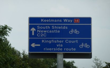
You will see a Jet garage ( the last place to buy some provisions for a long time ) when you meet the A187. Here follow Bewicke Rd until you reach the A187 again. This time cross the A187 and follow a cycle track, NCNRoute 14, down to the Pedestrian Tyne Tunnel.
 Cross the A187 at the end of Bewicke Rd. |
 Entrance of the Pedestrian Tyne Tunnel. Use the lift on the left. |
After passing through the pedestrian Tyne Tunnel, cycle up to the new roundabout and turn right following the road in a Westerly direction. At the next roundabout keep right folowing the NCN Route 14 signs.
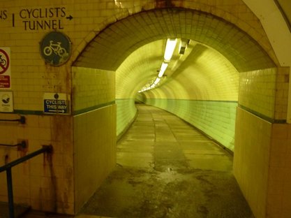 Cyclists tunnel |
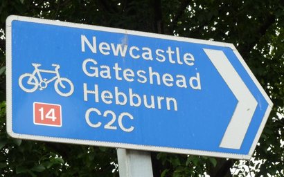 Follow the NCN 14 signs, until you see the NCN 11 sign. |
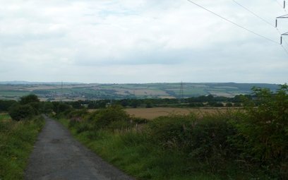
Look out for Potter street on your left that leads to Kings Court, a small industrial estate. The turning is indicated by the NCN Route 11 Monkton Cycleway sign. Passing under the Metro bridge, you will now follow a dismantled railway, the former Bowes Railway, for several miles until you reach the Bowes Museum. You will have to deviate from the line as Route 11 goes around Monkton Stadium and through Monkton Village. The route is very well signposted with Bowes Railway signs all the way to the museum railway which it at the site of Springwell Colliery.
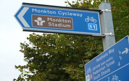 Follow the NCN Route 11 signs for the next 20 miles! |
 The beginning of the Bowes Railway path. |
You will reach the carpark of the museum and the B1288. At the far side of the carpark, cross the road and you will see a track running to the right of a patch of trees. Follow this, keeping left at a junction.
 The path is well sign posted |
 Opposite the Bowes Museum carpark, follow this bridle way around the landfill site. |
Cross the railway tracks and continue until you reach the Lambton Arms pub. Opposite the pub the path decends to the right around two sides of a fields before connecting with the route of the Bowes Railway again.
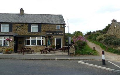 Looking back at the Lambton Arms |
 |
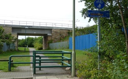
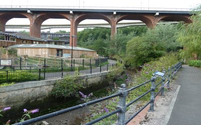
The route of the railway passes underneath the A1 and the East Coast Mainline railway. You will cross the river Team and Lambsey Reedbeds and begin to climb the other side of the valley.
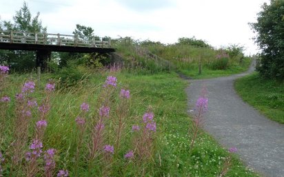 Rejoin the route of the Bowes Railway |
 Descend in to Team Valley. The most exciting part of this bike ride! |
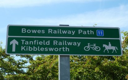
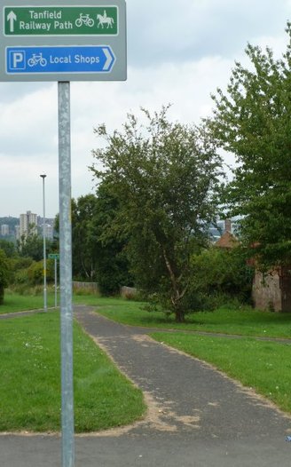
You will pass the site of the Kibblesworth Colliery and climb up to the site of the Blackburn Fell drift mine before reaching the Tanfield Railway.
 Sculpture on the way up towards Tanfield |
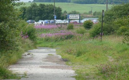 Approaching the Tanfield Railway, just after passing the site of the Blackburn Fell drift mine. |
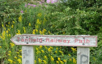
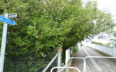
The bridge over the Tanfield Railway leads to the site of Marley Hill Colliery. Before this bridge, turn right through the car park and follow the Tanfield Railway Path.
 |
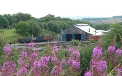 Marley Hill railway sheds |
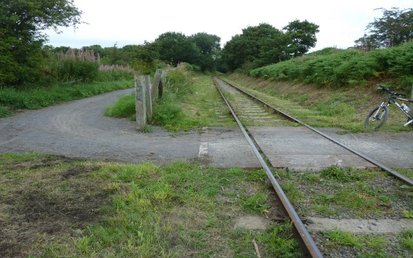
You will cross the tracks just before you reach the Sunniside 'Station'. Cross the road and continue to follow the route of the Tanfield Railway. You will cross the A692 Watergate Forest Park. Turn right and follow the path that passes a lake and runs past the side of Emmanuel College.
 |
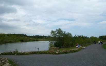 Watergate Forest Park |
Cross the B6317 and continue along the cycle track that runs through Lobley Hill, over the A1 via a footbridge and through a tunnel under athe Newcastle and Carlisle railway.
 Lobley Hill is the first opportunity to buy some snacks |
 Cross over the A1 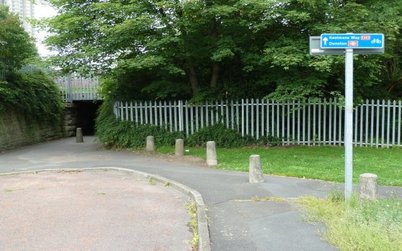 Pass under the Newcastle to Carlisle Railway |
After exiting the tunnel turn left along Ravensworth Terrace and begin to follow the NCN Route 14 signs. At the Tudor Rose pub turn right.
.
.
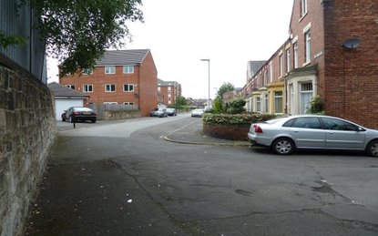 Head along Ravensworth Avenue |
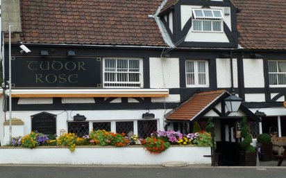 Turn right when you see the Tudor Rose pub |
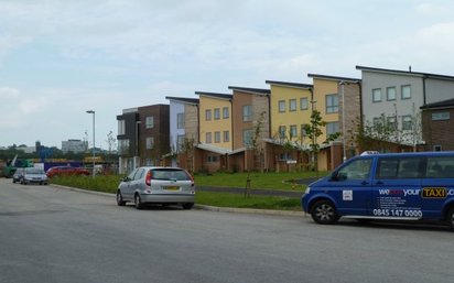
A soon as you have crossed over the river Team, take the first turn on your left and make you way through the new development to the path that runs along the edge of the River Tyne. Follow this path downstream and cross it at the Swing bridge.
 Follow the NCN Route 14 over the Team |
 Turn left down this street after crossing the River Team |
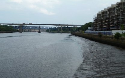
Enjoy the magnificent views of the Tyne Bridges. The view from the Swing Bridge is one of the best of Newcastle.
 Follow the new riverside path downstream to the Newcastle bridges |
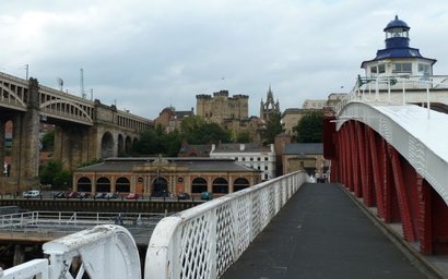 Cross at the Swing bridge |
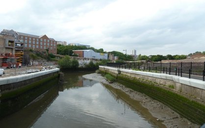
Turn left at the end of the Swing bridge and double back on yourself, looking for the bridge that passes under the Swing bridge. Continue downstream until you get to the mouth of the Ouseburn.
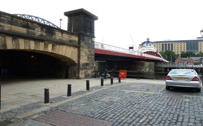 Double back and pass under the swing bridge |
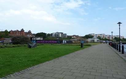 Pass the Tyne and Millenium bridges to get to the mouth of the Ouseburn |
Cross the Ouseburn and head left up Maling street, past the Tyne Pub. Follow the new riverside path up towards the Cluny and the Ship Pubs. Head towards the Byker bridges.
 Turn left and pass the Tyne pub |
 Follow the new Ouseburn riverside path |
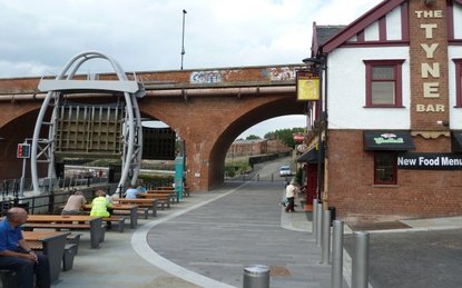
At the foot of the Metro bridge there is a steep path up the bank. (This path is closed at the moment due to works on the bridge.) Take this and at the top, turn right and follow the path across the playing field area to Warwick street. You will see the disused DFS store in front of you.
 Pass under the Ouseburn bridges |
 Cross Warwick Street and follow the Longbenton signs |
To the right of this follow Starbeck Ave and take the 2nd right along Stratford Grove west. 50 metres along here you will see the sign to Longbenton and Jesmond Dene. Take this path down into Jesmond Vale along Ouseburn Rd, all the way up to Jesmond Dene and past Pets Corner.
 Follow the Longbenton signs down into Jesmond Vale |
 Cross the Ouseburn and follow Ouseburn Rd |
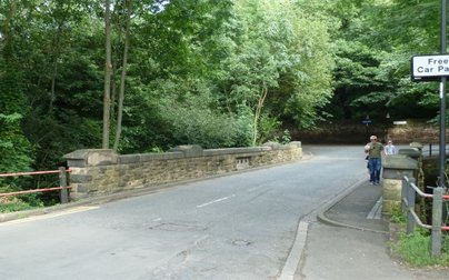
When you reach Fisherman's Lodge take the right turn up the hill and make your way up to Armstrong Park. Only local knowledge will help you get the right path here. Opposite the Freeman Hospital look for Melville Grove. Follow this until its end, where you will pass The St Francis Church. Turn right after the church and you are now following the route of the Coxlodge Wagonway. Cross the A188, Benton Lane, and continue to Coach Lane.
 Head up Melville Grove, which runs to the right of the Freeman Hospital |
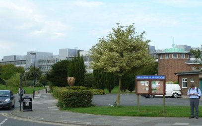 turn right after St Francis' church |
After you have crossed Coach Lane there are two bridleways. Take the one on the left.This cuts through a housing estate and follows the southern edge of NUFC training ground. You will reach the North East Mainline and turn left before the bridge that crosses it. Head up the hill and you are back at the entrance to the training ground.
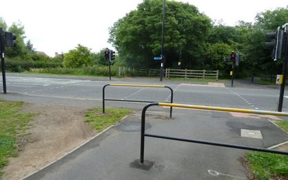 Cross Coach Lane and take the path 20m to the left of the traffic lights |
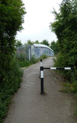 Turn left before you pass over the railway bridge |
